


If you’re in good shape and you’re going to visit America’s Grand Canyon in the state of Arizona, you should seriously consider hiking there.
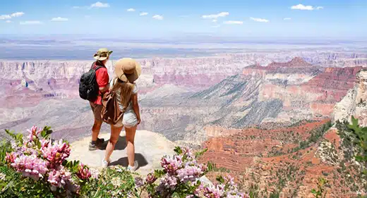 The scenic hiking trails there are the best way to truly experience this natural wonder. To help you determine which trails to hike, here are the 12 best hiking trails at the Grand Canyon.
The 12 Best Hiking Trails at the Grand Canyon
1. The South Rim Trail
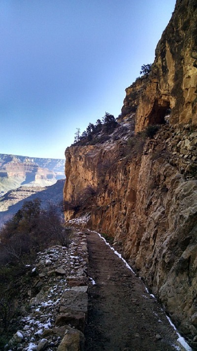
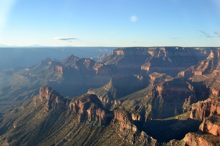
The well-known South Rim Trail is where many visitors first see the world-famous Grand Canyon. It is a paved, 13-mile route with a comparatively minimal elevation change. Mind you, you do not have to hike the entire 13 miles.
On this route, there are shuttle stops, joining scenic viewpoints with such park facilities as the informative Grand Canyon Visitor Center. Enjoy the views from such lookouts as Powell Point and Mather Point as you make your way along the popular South Rim Trail. Veteran visitors confirm that Yavapai Point is one of the best places to see the sunset. The viewpoints can be crowded during the summer months so get there early.
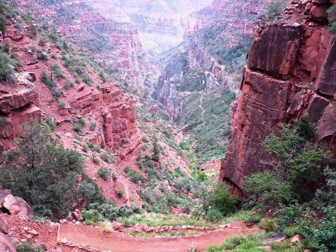
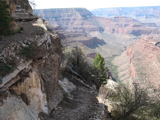
2 The Bright Angel Trail
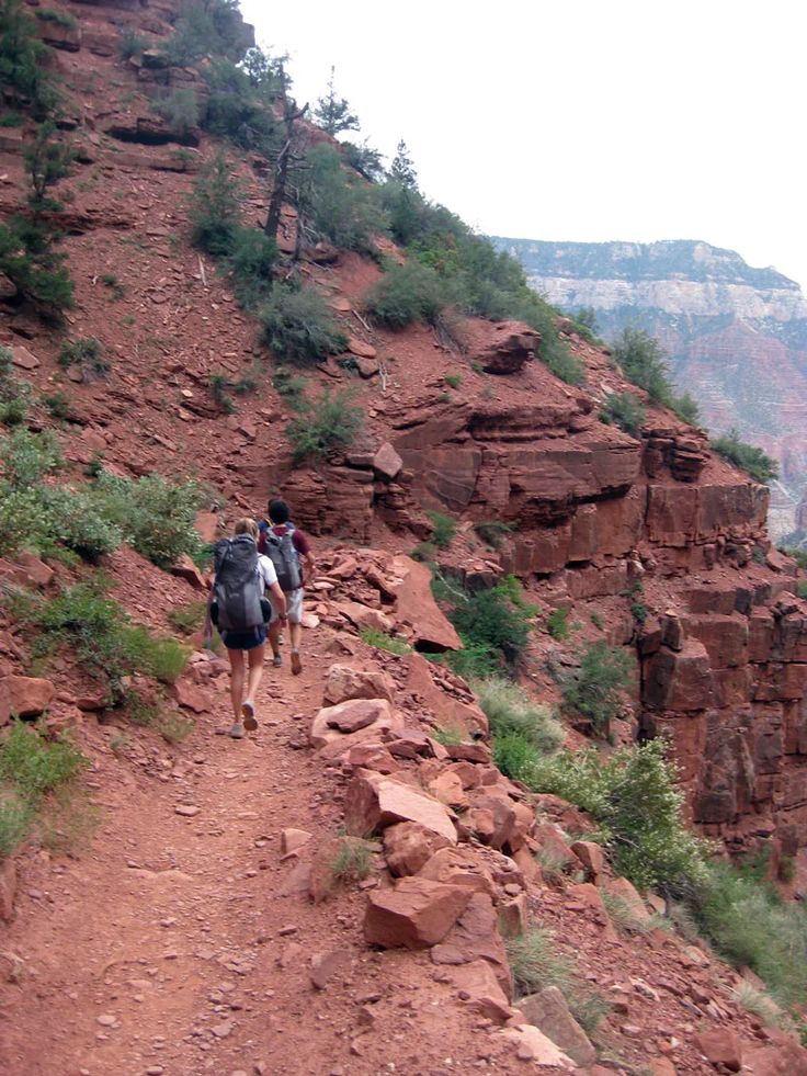
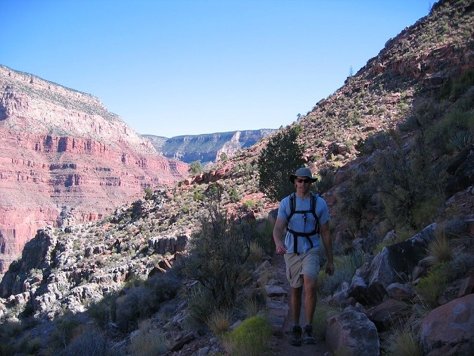
The popular Bright Angel Trail is arguably one of the most iconic hiking trails in the USA. The trail steeply descends from the popular South Rim, and soon reveals incredible views that can’t be seen from the rim itself. Within nine miles the trail descends more than 4,000 feet via seemingly endless switchbacks, from the rim to the rushing Colorado River.
It can, however, be dangerous for novices. Even though this hiking trail has had available water stations along the trail for a number of years, as many as 250 travelers are still rescued from the Grand Canyon every single year. Some inexperienced hikers try to complete the entire trail in a single day. Plan on making it a two-day hike and that will help avoid many issues.
3 The South Kaibab Trail
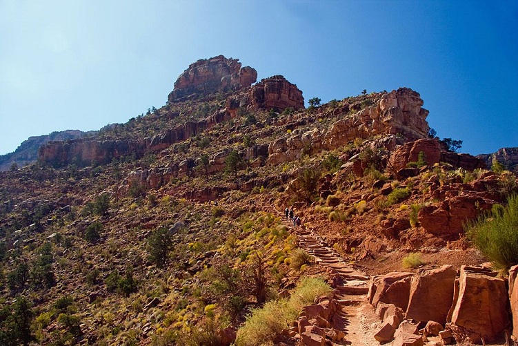
This trail drops almost 5,000 feet within seven miles between the well-known South Rim and the river. There are no water sources and little shade. Still, despite the challenges, the rock formations and views are stunning.
If you are interested in day hikes, consider the following turnaround points: Ooh-Aah-Point is only one mile down, Cedar Ridge is 1.5 miles, and Skeleton Point, is three miles and includes views of the river. This trail is also a trailhead for those who are going to backpack into the canyon. Many backpackers prefer the quick elevation hiking downhill.
4 Bright Angel Point Trail
Hiking the Bright Angel Point is now considered “a standard excursion” when one visits the North Rim. Here you will discover an easily accessible half-mile hiking trail that will lead you to what some say are the “best views of the canyon.” You begin the hike at the North Rim’s Visitor Center and Lodge.
It really is an exceptional introductory trail to complete upon arrival. You will find interpretive information both at the visitor center and along the way. Remember though, since this is the North Rim’s main outlook you will not be alone on this little hike so get there early.
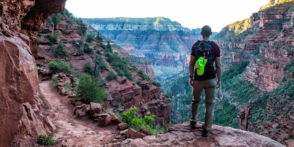
5 The North Kaibab Trail
This is the one and only officially maintained hiking trail that enters the Grand Canyon from the North Rim. Just like the Bright Angel and South Kaibab Trails, this trail has steep switchbacks the entire way down to the river. If you’d rather do a day hike rather than the rather demanding 14 miles down and back up again, use one of the numerous turnaround points on the trail.
At about five miles, you can turn back at Roaring Springs, the source of the park’s drinking water. Potable water is only available seasonally a healthy half-mile after at the Manzanita Rest Area, and 1.4 miles later, you can camp at the Cottonwood Campground, but you’ll need a permit. On the plus side, this trail is less crowded than its various southern counterparts, if you enjoy solitude.
6 The Havasu Falls Hike
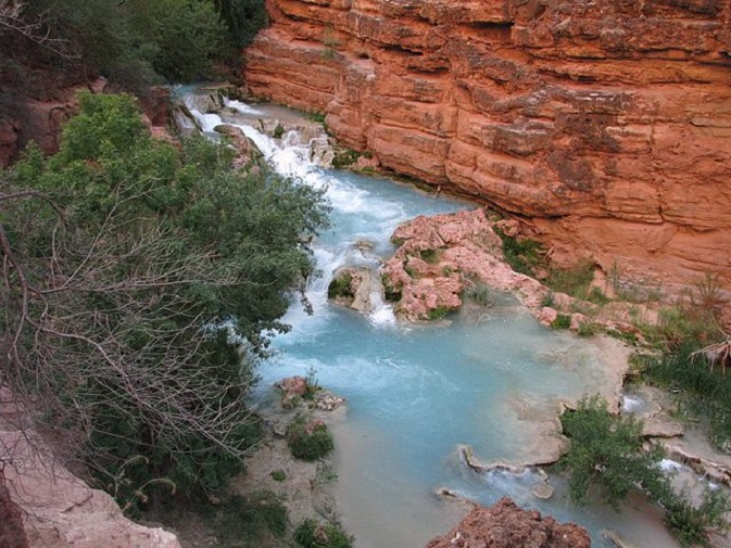
The Havasu Falls Hike is one of the country’s most well-known waterfall hikes. It’s important to remember that this trail is situated on the Havasupai Indian Reservation. Permits are required and they are not that easy to get.
Many people have hiking this trail on their bucket list not only to see the wonderful waterfall but also because of the surrounding scenery. The hike is considered moderately strenuous and covers at least 10 miles as well. Regular readers may already know that day hiking to the falls is not permitted. In order to see the falls, you must either do some backpacking and spend the night or choose to do some mule riding.
7 The Grandview Trail
This enjoyable hiking trail was actually created by old copper miners and their trusty mules. If you’re hoping to avoid the crowds often found on the nearby South Kaibab and Bright Angel Trails, then this South Rim hiking trail fits the bill. This admittedly steep route is also a fine backpacking trail and it’s easier to get a permit for this one too.
Atop Horseshoe Mesa you will find historical mining remains and popular places to camp should you wish to do more than go day hiking. Horseshoe Mesa is also a great place to turn around if you’re just day hiking. The hike is less than six miles and the elevation is under 3,000 feet.
8 The Widforss Trail
You’ll discover this scenic hiking trail on the North Rim. It’s named for the 20th-century artist, Gunnar Widforss, who was well-known for his paintings of the Grand Canyon. For two miles it follows the North Rim and provides pretty panoramas of the canyon’s quieter side. It continues on through a shaded forest still showing some signs of past forest fires there. Following mile five, you emerge from the forest to enjoy additional attractive views at popular Widforss Point.
9 The Cape Final Trail
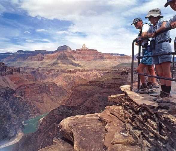
Try hiking the Cape Final Trail on the North Rim. This family-friendly, four-mile hike features memorable views, moderate elevation change, a generally level trail, and quite often no real crowds. This trail winds through the verdant forest and along the edge of the canyon, eventually leading you to the Cape Final viewpoint where you will enjoy stunning views. From this popular precipice, your peepers can peruse plenty of prominent features of the gorgeous Grand Canyon such as the canyon’s eastern edge and the Vishnu Temple.
10 The Hermit Trail
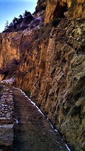
If you’re looking for a good alternative to rim-to-river-hiking trails on the bustling South Rim, the Hermit Trail, on the western edge of the park, is for you. It offers what some call a “more solitary” experience. In the first two and a half miles, the trail actually drops a total of 2,000 feet.
The drop does make the hike back up a little challenging. Indeed, some experts say only experienced desert hikers should attempt this hike. During the park’s early years, it was actually the official main thoroughfare into the canyon.
Today, much of the foot traffic is the result of day hikers because there are only a few campsites available. Santa Maria Springs, 2.5 miles below the rim, is a good turnaround point. Water’s available here but it must be treated.
11 The Rim-to-Rim Trail
Regular readers know your rovin’ writer hiked the Grand Canyon rim-to-rim with his father and a small group of scouts over two days. However, if you want to hike it in one day, consider this trail. This trail is 24 miles in length between the North and the South Rims.
Expect an elevation gain of over 4,500 feet and be aware that you should only attempt to hike this in one day if you are an experienced, healthy, long-distance hiker. It’s also important to note that you need to hit the trail before daybreak. If you prefer, you can take a shuttle ride back to the starting point (from May to October). If you’re interested in this challenging adventure, be sure to contact the people at the Backcountry Information Center for additional information.
12 The Rim-to-Rim-to-Rim Trail
If you’re really hardcore, this is arguably the Grand Canyon’s ultimate adventure hike. The route is generally the same as the previous hike, but rather than wait for the shuttle or call Uber, you basically turn around and do the 24-mile hike once more. As previously noted, rim-to-rim hikes can be completed in two or more days if you obtain a backcountry permit.
In fact, if you carry your own gear, the popular Bright Angel Campground is nestled in the middle of the trail route close to the Colorado River. There are similar primitive campgrounds on the nearby North Kaibab Trail. This is almost a 50-mile journey and is only permissible during the day. Unless you possess the proper training, you should not attempt it in a single day. The best time to hike this challenging trail is from May to October.